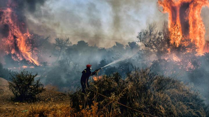
Every summer in Lebanon now feels like a countdown to wildfire outbreaks. An increasing number of hotter days, drier conditions, stronger winds, and longer fire seasons are turning vegetated landscapes into fuel. In Lebanon, wildfire risk is no longer a routine seasonal concern. Fires increasingly threaten environmentally sensitive areas, including protected sites, agricultural livelihoods, vulnerable high-mountain ecosystems, and the safety of nearby communities.
Digital technology is often presented as the solution, e.g., satellites, drones, dashboards, and artificial intelligence. But there is always a catch! In a country like Lebanon, these tools do not function on their own. They require constant funding, trained staff, institutions capable of operating and maintaining them over time, and adaptation to local conditions. In other words, we cannot claim smart wildfire management if the tools we adopt are both resource-intensive and not adapted to run locally.
Yet, digital technology can significantly improve wildfire research and monitoring, readiness, risk reduction, response and recovery, but only if it is designed for efficiency, grounded in local needs, and deployed with a clear strategy to run smoothly and efficiently.
Why Wildfire Management Needs Digital Tools Now
Until present, wildfire response is still too reactive. By the time smoke is visible from a house or a road, the fire has often already escaped initial control. In a country like Lebanon, where rugged terrain, limited resources, and overlapping land uses complicate firefighting, minutes matter. In this context, technology helps shift wildfire management from reaction to anticipation.
Starting with remote sensing, satellite systems provide updated wildfire information across large landscape areas, supporting situational awareness and reporting at local, national, and regional scale. In practical terms, satellite-derived fire products help answer questions that decision-makers urgently need:
Where are the fire hotspots?
How fast is the fire spreading?
What areas are burned, and at what severity?
What is the state of post-fire vegetation recovery?
Then there is geospatial analysis by combining satellite imagery with weather, terrain, and vegetation to map where the next fire is likely to ignite and spread. Risk maps can guide risk reduction (clearing fuels, setting up fire breaks), preparedness (pre-positioning infrastructure and response teams), and land management decisions (where restoration should be prioritized, where grazing can reduce fuels, where development should be restricted).
Early Warning isn’t Just a Siren, it’s a System
Previous experiences have shown that a wildfire early warning system is not merely an alert; it is an integrated chain of actions. It begins with forecasting fire risk, then moves to early detection of ignitions, followed by timely communication to communities, and ultimately enables rapid and coordinated response. Lebanon already has a solid foundation to build on, including national platforms that provide fire danger information and warnings.
The strongest early warning systems work at reducing risk before an emergency happens. This is why digital tools must connect science to action. Fire danger indices, near-real-time satellite detections, and local reporting apps become truly valuable only when embedded into local and municipal response procedures and Civil Defense operations.
Akkar: a Practical Example of Technology Combined with Cmmunity Action
Akkar offers a clear illustration of both the challenge and the opportunity. The region combines highly fire-prone landscapes, vulnerable rural communities, and limited institutional capacity, yet it also has strong local networks that can be mobilized for prevention and rapid response.
In recent years (between 2022 and 2024), the Ministry of Environment launched initiatives in Lebanon, including in Akkar, that emphasized early warning systems and local coordination, supported through partnerships with national institutions and community-based groups. The focus was clear and straightforward: reducing wildfire risk is not only about firefighting equipment, but also about preparedness, information flow, and community readiness.
This was an example where digital systems proved their value. Daily fire danger forecasts, combined with a well-established communication and coordination mechanism,including follow-up WhatsApp groups, enabled communities and local actors to anticipate high-risk days, enhance patrols, and respond faster to ignitions. When paired with targeted awareness campaigns addressing the main causes of fires, the result was tangible: burned areas declined by more than 85% compared to long-term annual averages. The message is simple: technology doesn’t replace people; it helps organize collective action.
The Real Future: Digital Landscapes, Not Digital Dashboards
Wildfire management is ultimately landscape management. Technological tools including remote sensing and early warning systems should always be linked to sustainable land practices such as grazing planning, restoration, agroforestry, protected area zoning, and community-based fuel management.
If Lebanon invests in digital wildfire tools as part of its 2023 updated national strategy for forest fire risk reduction, especially in high-risk regions, it can protect forests while also strengthening local livelihoods and institutional coordination.
But we must insist on one principle: in a rapidly changing environment and world, technology should be judged not by how advanced it looks, but by how well it supports communities, and how effectively it reduces risks.
George Mitri, Professor of Environmental Sciences, Director, Land and Natural Resources Program, Institute of the Environment, University of Balamand, Lebanon