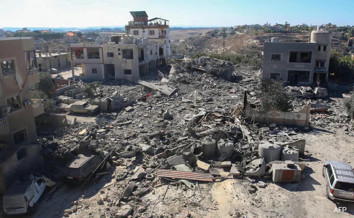
LEBANON — A joint report by the United Nations Development Programme (UNDP) and Lebanon’s National Council for Scientific Research (CNRS-L) has revealed widespread destruction across South Lebanon as a result of the conflict, with structural losses estimated at more than USD 1.38 billion.
The report, the second in a series of assessments using geospatial artificial intelligence (GeoAI) and remote sensing technologies, is based on the analysis of high-resolution satellite imagery captured between October 23, 2025, and April 29, 2026.
The assessment aimed to document damage to buildings, particularly in areas south of the Litani River.
According to the findings, 11,095 buildings were completely destroyed, equivalent to 17,891 housing or property units. An additional 2,242 buildings sustained partial damage, while 9,311 buildings were recorded as having minor damage.
The report estimates the preliminary cost of structural damage at approximately USD 1.384 billion, based on a standardized replacement cost of USD 450 per square meter, adjusted to reflect prevailing market inflation.
The destruction also generated around 3.1 million cubic meters of debris and rubble, with an estimated weight ranging between 5.25 million and 6.99 million tonnes, posing major challenges for debris removal and reconstruction efforts.
Nabatieh Suffers the Greatest Damage
The assessment found that Nabatieh Governorate bore the largest share of destruction, with 8,989 buildings completely destroyed, compared with 2,106 destroyed buildings in South Governorate. Nabatieh also recorded 1,190 partially damaged buildings and 5,247 buildings with minor damage.
At the district level, Bint Jbeil was among the hardest-hit areas. The town of Aitaroun recorded the highest number of destroyed buildings at 1,658, followed by Bint Jbeil with 1,076 and Aita al-Shaab with 539. In Marjayoun District, Mais al-Jabal recorded 961 destroyed buildings, while Khiam registered 824. In Tyre District, Burj El-Shemali recorded 370 destroyed buildings, followed by Naqoura with 216.
Preliminary Estimates
The report’s authors stressed that the findings remain preliminary and are intended to support programmatic planning and response prioritization until comprehensive field verification becomes possible.
They also noted that the assessment is limited to above-ground building damage and does not include damage to critical infrastructure such as roads, bridges, electricity networks, water systems, and telecommunications infrastructure, nor does it account for underground structures. As a result, the actual scale of losses may be higher than current estimates suggest.